News

Innovation in Digital Twins: the importance of point clouds
Point clouds (PCs) emerge as fundamental tools in the creation of 3D models, spatial navigation and visual communication via immersive videos, the so-called "fly throughs". This technology transforms the perception of detected objects, making them immediately accessible for various purposes, from technical analysis to simplified communication. However, the management of point clouds presents notable challenges, linked above all to the need to combine technical aspects with productive and communicative ones. Despite this complexity, the communicative capacity of point cloud-based videos often surpasses that of static 3D models, offering a more intuitive and engaging representation of detected objects.
POINT CLOUDS AND DIGITAL TWIN
In the context of the AEC (Architecture, Engineering, Construction) industry, the concept of Digital Twin has gained increasing importance, becoming central in industrial, urban planning and environmental applications. The Digital Twin uses point clouds to create detailed digital models of physical objects or environments, which can then be used for real-time simulations and monitoring. These models are based on data acquired using advanced techniques such as laser scanning, photogrammetry or LiDAR sensors, which together provide a precise reconstruction of the shape and structure of detected objects.
DISPLAY AND NAVIGATION, BETWEEN OPEN TOOLS AND ADVANCED TOOLS
The management and visualization of point clouds, which often include very large data, requires the use of specific software tools. Among these, CloudCompare stands out for its detailed analysis capabilities, allowing users to examine point clouds in depth. Potree, on the other hand, offers a web platform that allows you to view and navigate 3D data directly from your browser, making it easier to access and share data. Finally, Google Earth integrates point clouds into a realistic geographic context, significantly improving the usability of 3D models and providing a powerful tool for interactive geospatial visualizations.
CONCLUSIONS
Point clouds have become essential to the creation and effectiveness of Digital Twins, ensuring precision and detail critical for successful implementation. The choice of tools for viewing and navigating Digital Twins is crucial and varies depending on the specific needs of the project. The synergistic use of advanced platforms such as CloudCompare, Potree and Google Earth not only elevates the quality of the project but also facilitates informed decisions, pushing innovation and progress in various application fields, such as industry, urban planning and the environment.
-
04/10/2024

Exploring the Potential of Renewable Energy Communities -
19/07/2024
Innovation in Digital Twins: the importance of point clouds -
12/04/2024
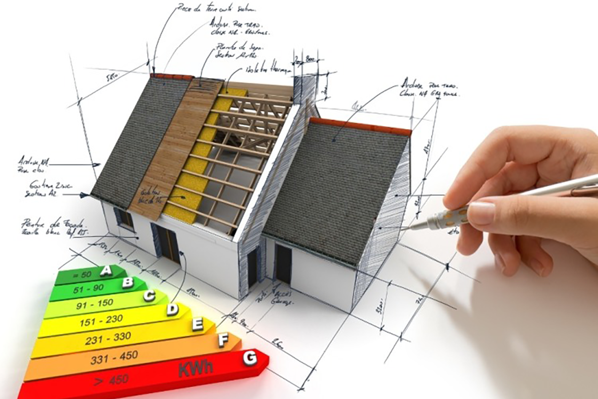
Improvement of the energy class of a building by focusing on renewable sources: intervention scenarios -
10/01/2024
COP28: A Global Commitment to a Sustainable Future through Energy Efficiency -
11/12/2023

Eco-sustainable homes: well-being for the planet and health -
02/10/2023

Aerial-photogrammetric survey with drones: the technology that is changing the construction sector -
07/08/2023

Removal of Architectural Barriers: Bonuses and Solutions -
22/06/2023
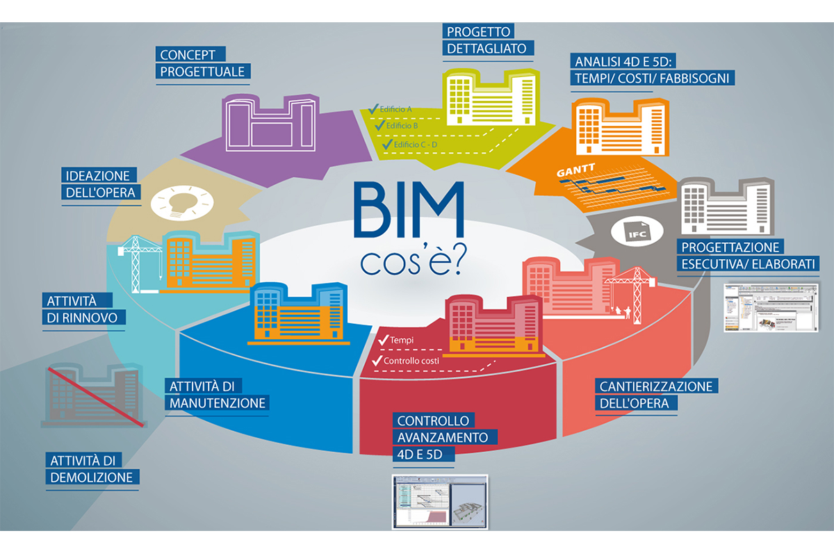
BIM Design: The Revolution in the Construction Industry -
19/05/2023
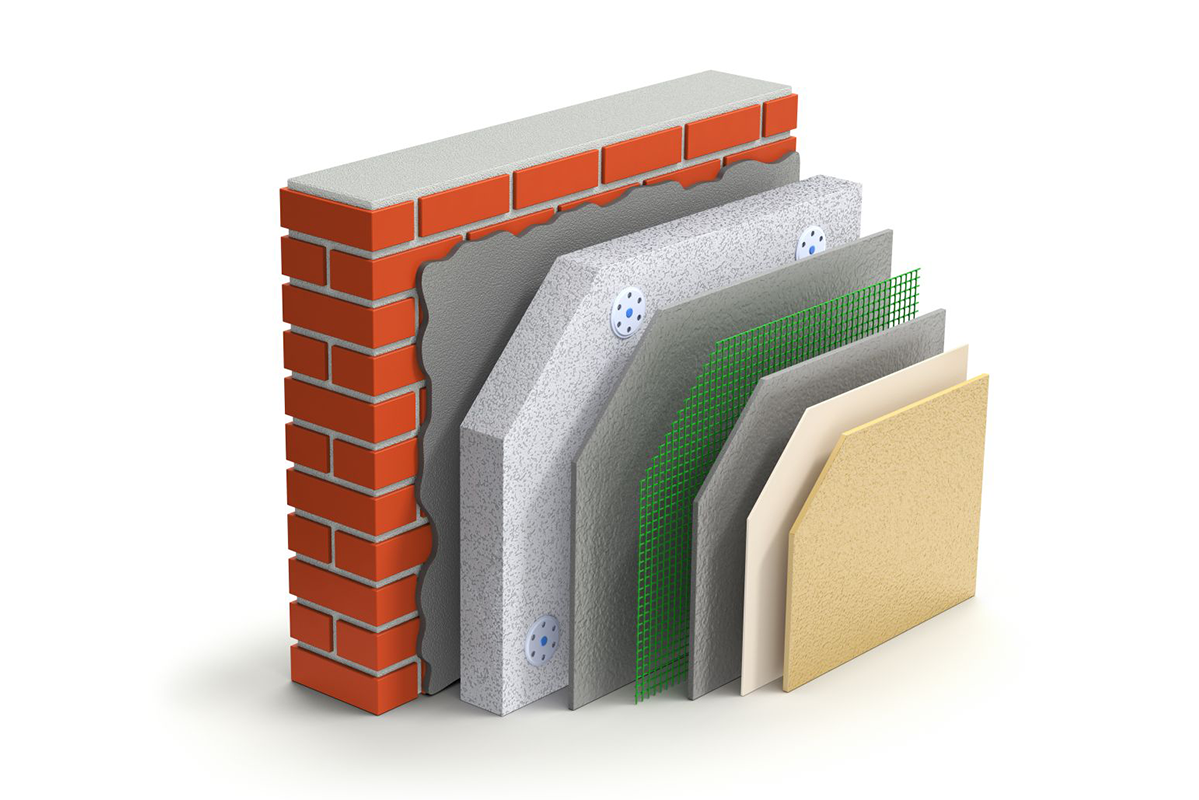
The Façade Coating for Homes: A Modern and Sustainable Solution